Stewardship Tip: Mapping Trails for TrailFinder
Just like that, another two weeks has flown by! I have had a fantastic time working with Shawn, another UNH Cooperative Extension Intern, mapping trails for Trail Finder. Trail Finder is a website that has interactive trail maps featuring trails all over New Hampshire and Vermont. This site is a collaborative effort between many different organizations and agencies to make the public aware of and promote the use of trails in their area.

Shawn and I had the opportunity to map trails for the Town of Brentwood, the Town of Sandown, New Hampshire Audubon, and the Town of Northwood.
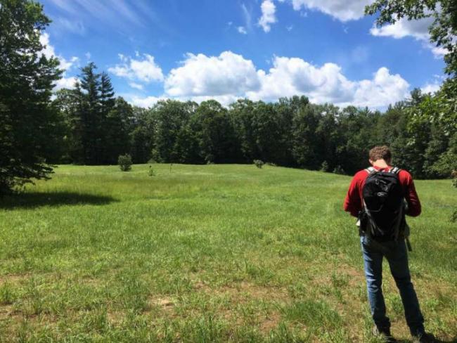
We started the majority of our days by locating the trailhead, then we would turn on our GPS units and start walking the trails. Luckily, we often had a base map with us to point us in the right direction. Once the GPS data is collected, a map and trail page can be made. While we hiked, we also marked waypoints if there was something to take note of.
When we weren’t out exploring, Shawn and I returned to the UNH Cooperative Extension Rockingham office, where he inputed our GPS data into ArcGIS to make it website-worthy, and I worked on building trail pages, including trail descriptions, directions to the trailhead, pictures of the area, and any rules for the property.
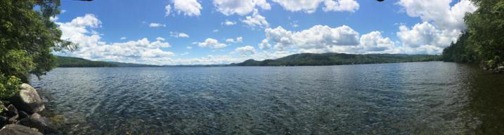
My favorite day working for Trail Finder was when we mapped three properties for New Hampshire Audubon in Hebron, NH, next to Newfound Lake. After a minor struggle with the driving directions, we walked through three different properties, and they were absolutely beautiful! We walked through fields of wildflowers, dense forests, and along the banks of the lake.
These last two weeks have been an incredible opportunity to explore local properties and trails. New trails constantly are being added to the Trail Finder website, so make sure to check it out the next time you are ready for an adventure!
