Connecting People to Trails in the Digital Age
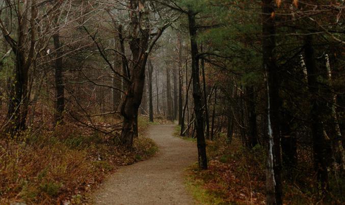
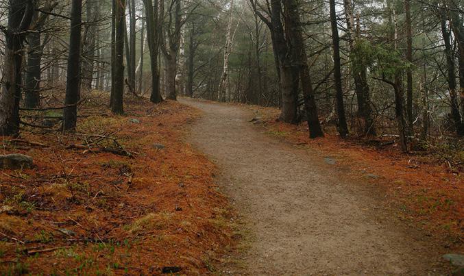
From Warren’s Town Forest Trail Network in the White Mountains to the Southeast Land Trust of New Hampshire’s Piscassic Greenway Trail in Newfields, new local trail maps are being added each week to the Trail Finder website from communities all over New Hampshire. The Trail Finder Project aims to make it easy for people to get outside and enjoy local trails by putting them all on one website. Trailfinder.info offers a one-stop-shop for trail maps across New Hampshire and Vermont (Mainers can go to mainetrailfinder.com). Originally launched as a collaborative effort in the Upper Valley led by the Upper Valley Trails Alliance, Trail Finder is expanding across New Hampshire through a new partnership with UNH Cooperative Extension and support from the National Park Service Rivers, Trails, and Conservation Assistance Program.
Trail Finder is unique because it only features trail maps provided with the permission and consent of each landowner or trail manager. Trails get their own interactive Trail Page on the website, which includes a brief description, quick facts like allowed recreational uses, current weather, nearby Geocaches, rotating Leave No Trace Principles, and an interactive Legend where users can toggle information and trail sections on and off. GPS-savvy users can even download map data in KML and GPX formats before they head out on the trail. Users can also find trailheads and parking, locate nearby connecting trails, and see alerts, such as trail closures, provided by the trail manager. After their visit, users can even share a photo or experience from the trail in the comments section on the trail page.
Support from the Dalrymple Community Engagement Fund at UNH Cooperative Extension provided an opportunity for UNH graduate student Holly Fosher to work alongside Emma Tutein, an Extension field specialist in natural resources and land conservation and team member of the Stewardship Network: New England to expand the collaborative digital trail mapping effort.
We recently talked with Holly about her experience working on the Trail Finder Project to get an idea of the project in her own words. They are inspiring! It should be no surprise, but it turns out community volunteershave a lot to do with helping New Hampshire residents get outside, get active, and explore local trails.
Emily Lord (TSN:NE): We know the Trail Finder project is aimed at better connecting people to trails on conservation lands in New Hampshire. Can you tell us more about what that means for the average citizen?
Holly Fosher (HF): For the average citizen, this means that people will have more awareness and access to varying trails in New Hampshire and in their immediate community. Today, the Internet is a huge source of where people get their information. Having one website where people can find trails in New Hampshire will ensure that we are not missing an entire population of people who access information that way. When I first heard of this project a memory came to mind of when I was looking to hike a trail with my friend and we immediately went to Google to find local trails. The only sources we found were on blogs from users, and trail maps were difficult to find. We ended up on a trail that was not groomed and got lost for a couple of hours based on one of these blogs. Now I am so excited to have one website where trails can be uploaded and information will be correct since it is coming straight from the trail owners and not third parties.
TSN:NE: As the 2016 Dalrymple Community Engagement fellow, can you share how mapping trails is related to community engagement?
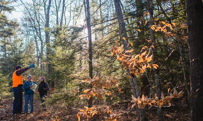
HF: Mapping trails is related to community engagement because most often the people who are working on trails and helping map them are volunteers who come from local towns. I have heard from a lot of conservation commissions that members in the community, such as Boy Scouts and others, will come out to help map, create kiosks, and maintain the trails as well. It is an effort not just by people who are on town committees, but also by community members who truly care about their trails.
TSN:NE: You’ve also been gathering information about town-owned trails in Rockingham and Strafford Counties. What have you found so far?
HF: My initial take away from my interviews so far has been that everyone is excited about Trail Finder! For most communities, they want to bring more people to their trails and ensure that people at the very least know they are there. Mapping trails is where towns vary the most- some towns only have hand drawn maps and are not completely sure where all their trails are, while other towns have GIS maps. In terms of concerns, the largest topic has been that having maps online may lead to overuse, which would require an increase in maintenance or posting notices near sensitive areas.
TSN:NE: How do you feel about community engagement now versus before you started this fellowship?
HF: I feel like my eyes have been opened to an overwhelmingly positive network that communities have. Many of the conservation commissioners or other people on trails committees are doing the work as volunteers to give back to their communities. Many people have talked about how their communities have been extremely involved, including one town that says they only buy supplies for repairs and community members and trail users come together to build bridges and fix up the trails themselves. Before conducting research, I never realized how our conservation lands bring people together for a great cause.
TSN:NE: How has the project impacted your studies as a Masters student in Recreational Management and Policy at UNH?
HF: It has greatly impacted my studies in Recreation Management and Policy, as before I heard about this project I wasn’t sure what direction I wanted to take my thesis. I have a wide variety of interests including outdoor recreation, event planning, and student development. Once I got involved with the Trail Finder Project and Emma and I started designing questions for communities, I started to see how I could take on more interviews and do research to transform this into my graduate thesis. I have been doing a lot of research on how varying forms of marketing affect awareness and usage of trails. I conducted interviews for the fellowship, but I also plan on analyzing this data for my thesis. Even though my fellowship has ended, I will continue to use what I have learned from it in the next four months I have left of school!
TSN:NE: What has it been like working alongside Extension professionals?
HF: It has honestly been wonderful to work with the professionals from UNH Cooperative Extension. I was invited to go to the Community & Economic Development program’s monthly workshop-meetings, where I have learned a lot. For example, one of the sessions was about how to have an engaging presentation, and I ended up using a lot of the speaker’s tips later that semester in one of my classes. Everyone welcomed me into the community, learned my name, and always asked me about what I was doing. I gained a deep appreciation for the work that they do, as before I never knew exactly what UNH Cooperative Extension did.