Southern Maine Beach Profile Monitoring Program
- January 1–December 31
This is an ongoing Citizen Science Experience. Contact the sponsoring organization to join in.
Family-Friendly
No
High Adventure
Yes
Setting
Description
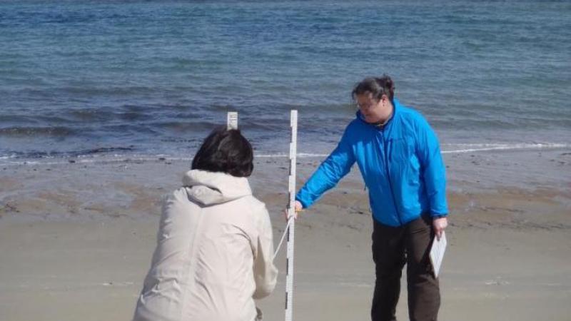
Do you love collecting data with your toes in the sand? This data is used to inform beach management decisions at the local and state level. Beach profiling is a simple surveying technique used to measure changes in the contour of the monitored beach. Monitoring takes place once each month for approximately 2-3 hours. Volunteers monitor all year. Ideally volunteers would be able to commit to 7-8 monitoring dates per year.
Beach Profiling in Southern Maine Website
Project Goal?
This project's goal is to track erosion and accretion of sand along the sandy beaches of Southern Maine. Our data is shared directly with the Maine Geological Survey and is publicly available. The data has been used in the past to inform management decisions as well as track the success of various beach nourishment projects.
Where does the project take place?
The project takes place at 11 different beaches along the coast of Southern Maine from Long Sands Beach in York to Willard Beach in South Portland.
When can volunteers participate?
Profiling is conducted once a month with occasional extra profiles request to assess storm damage. Times vary, but we aim for the lowest daylight low tide that falls on a weekend.
Is training needed to participate?
Training is needed but can be trained in the field during a first scheduled profiling trip!
Who is this project ideal for?
Anyone 13+ (minors just need a signed waiver from a parent/guardian).
How to get started on this project?
Reach out to the program coordinator below!
Questions? Contact:
Jacob Aman, the volunteer coordinator, at jacobaman@wellsnerr.org, 207-646-1555 x112